Bài đọc
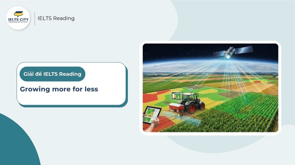
Growing more for less
Satellite technology is helping farmers boost crop yields.
A. For farmers, working out the optimal amount of seed, fertiliser, pesticide and water to scatter on a field can be a matter of luck, despite several harvests. Regular laboratory analyses of soil and plant samples from various sections of a field can help — but such expertise is costly, and often unavailable. However, a new and cheaper method of doing this analysis is now on offer. Precise prescriptions for growing crops can be obtained quickly, and less expensively, by calculating the amount of electromagnetic radiation reflected from agricultural land. The data is collected by orbiting satellites.
B. Examining the wavelength of radiation that is reflected can reveal, with surprising precision, the properties of the soil, the quality of crop being grown, and the levels in those crops of chlorophyll, various minerals, moisture and other indicators of their quality. If recent and forecast weather data is added, detailed maps can be produced indicating exactly how, where and when crops should be grown. The service usually costs less than US $15 per hectare for a handful of readings a year, and can increase yields by as much as 10%.
C. Such precision farming using satellite-based intelligence is a relatively new technique. Even so, it is catching on quickly. Five years ago, for example, a French cereal-growers’ co-operative called Sevepi purchased a satellite and makes it available to its members in the form of maps of their fields, divided into three or four colour-coded zones per hectare. For each zone, the exact and best fertiliser formula is recommended. On top of this, if the amount of rain in the field has already grown quite high early in the season, and heavy showers are expected, an appropriate dose of growth regulator is recommended for each zone (as fragile stems break more easily in downpours). Then, farm vehicles equipped with global-positioning system locators automatically mix and apply the prescribed dose to each area.
D. France is the pioneer in this sort of surveillance. More farmland is analysed by satellite there than in any other country, according to Infoterra (a subsidiary of EADS Astrium), the firm that is France’s largest provider of such information, supplying data to companies such as Sevepi. Moreover, Henri Douche, head of Infoterra’s agriculture sales in Toulouse, reckons the amount of monitored farmland will increase as weather patterns change and farmers can no longer rely on the past as a guide to the future. When confounded by the yield variations that these new weather patterns will bring, even farmers who are afraid of new technology will sign up, he says.
E. Inexpensive data on the productivity of land is advantageous to governments too. Areas where fertilisers and pesticides are being applied excessively can be pinpointed, enabling a reduction in environmental and land-use damage. Says Guy Lafond, an agronomist with Agriculture and Agri-Food Canada, a government agency, says the satellite data it purchases is proving useful for the study of fields with declining productivity in the province of Saskatchewan. Over-application of nitrate fertilisers (which are also a source of greenhouse gases) appears partly responsible. And according to RapidEye, a German satellite operator, some companies are also studying satellite data with a view to selling insurance policies to governments of famine-prone countries that might be threatened by crop failure.
F. In March, RapidEye began selling data that helps forecast harvests. “Too often, farmers limit productivity by managing fields wrongly,” says Fredrick Jung-Rothenhäuser, head of product development at the firm’s headquarters in Brandenburg an der Havel. “Our satellites are the first commercial satellites to include the Red-Edge band of the light spectrum, which is sensitive to changes in chlorophyll content. More research will be necessary to realise the full benefits of the Red-Edge band. However, this band can assist in monitoring vegetation health, improving species separation and also help in measuring protein and nitrogen content in biomass.” The company’s data, which comes from both Europe and the Americas, breaks field productivity down into patches just five metres square.
G. The advantages that satellite technology provides in terms of precision farming do not have to be restricted to rich countries. In Africa, where many areas have become badly depleted of nutrients, better fertiliser management would help reverse this situation. As a consequence, the charitable trust World Agroforestry Centre, in the city of Nairobi, in Kenya, has begun to build up a collection of radiation patterns derived from around 100,000 samples of African soils. The aim of this work is to help by understanding the potential of these soils to be more agriculturally productive. Once passed on to the International Centre for Tropical Agriculture, based in Colombia, South America, it is intended that the information be used to build a database called the ‘Digital Soil Map’. When complete, this will provide farmers with free forecasts, developed with regularly updated satellite imagery, across farmland in the poorest countries in Africa. This is information which will almost certainly assist in improving crop yields. For a hunger-ravaged continent, that is good news indeed.
Kiến thức cần nắm:
Câu hỏi
Questions 14–20
Reading Passage 2 has seven paragraphs, A–G.
Which paragraph contains the following information?
Write the correct letter, A–G, in boxes 14–20 on your answer sheet.
You may use any letter more than once.
- 14. an example of how farmers in one country are now using satellite data to determine fertiliser use
- 15. a reference to climate change and its effects
- 16. a reference to the effect on the soil of using too much fertiliser
- 17. an example of information that will be shared between different countries
- 18. mention of the country which is the leader in agricultural technology
- 19. a description of an innovation in satellite imaging which requires further study
- 20. evidence of the cost-effectiveness of using satellite technology in agriculture
Questions 21 and 22
Choose TWO letters, A–E.
Write the correct letters in boxes 21 and 22 on your answer sheet.
Which TWO companies obtain information directly from satellites?
- A. Sevepi
- B. Infoterra
- C. Agriculture and AgriFood Canada
- D. RapidEye
- E. World Agroforestry Centre
Questions 23–26
Complete the sentences below.
Choose NO MORE THAN TWO WORDS from the passage for each answer.
Write your answers in boxes 23–26 on your answer sheet.
23. Initially, orbiting satellites are used to measure …………… coming from farmland.
24. Fredrick Jung-Rothenhäuser says that additional irregular weather will raise the …………… of satellite technology.
25. As a result of satellite technology, it may become possible to insure against the threat of …………… in some countries.
26. In Africa, much of the soil suffers from the loss of …………… .
Đáp án
Questions 14–20: Matching Information
14. an example of how farmers in one country are now using satellite data to determine fertiliser use
- Đáp án: C
- Giải thích: Đoạn C đưa ra ví dụ về các nông dân ở Pháp (“a French cereal-growers’ co-operative called Sevepi”). Họ sử dụng bản đồ vệ tinh để xác định “công thức phân bón chính xác và tốt nhất” (exact and best fertiliser formula) cho từng vùng.
- Vị trí và trích dẫn: Đoạn C.”…a French cereal-growers’ co-operative called Sevepi… For each zone, the exact and best fertiliser formula is recommended.”
15. a reference to climate change and its effects
- Đáp án: D
- Giải thích: Đoạn D đề cập đến việc các kiểu thời tiết thay đổi (“weather patterns change” – tương đương climate change) và nông dân không thể dựa vào quá khứ để dự đoán tương lai nữa.
- Vị trí và trích dẫn: Đoạn D.”…Henri Douche… reckons the amount of monitored farmland will increase as weather patterns change and farmers can no longer rely on the past…”
16. a reference to the effect on the soil of using too much fertiliser
- Đáp án: E
- Giải thích: Đoạn E nói về việc bón quá nhiều phân đạm (“Over-application of nitrate fertilisers”) chịu một phần trách nhiệm cho việc giảm năng suất đất ở Saskatchewan.
- Vị trí và trích dẫn: Đoạn E.”Over-application of nitrate fertilisers… appears partly responsible.”
17. an example of information that will be shared between different countries
- Đáp án: G
- Giải thích: Đoạn G nói về thông tin được thu thập ở Kenya (châu Phi) sau đó được chuyển đến Colombia (Nam Mỹ) để xây dựng cơ sở dữ liệu.
- Vị trí và trích dẫn: Đoạn G.”Once passed on to the International Centre for Tropical Agriculture, based in Colombia, South America…” (từ World Agroforestry Centre ở Kenya).
18. mention of the country which is the leader in agricultural technology
- Đáp án: D
- Giải thích: Đoạn D khẳng định Pháp là người tiên phong (“pioneer”) trong loại hình giám sát này và có nhiều đất nông nghiệp được phân tích hơn bất kỳ nước nào khác.
- Vị trí và trích dẫn: Đoạn D.”France is the pioneer in this sort of surveillance. More farmland is analysed by satellite there than in any other country…”
19. a description of an innovation in satellite imaging which requires further study
- Đáp án: F
- Giải thích: Đoạn F mô tả dải quang phổ “Red-Edge band” (một sự đổi mới) và nói rằng cần nhiều nghiên cứu hơn để nhận ra hết lợi ích của nó.
- Vị trí và trích dẫn: Đoạn F.”Our satellites are the first commercial satellites to include the Red-Edge band… More research will be necessary to realise the full benefits…”
20. evidence of the cost-effectiveness of using satellite technology in agriculture
- Đáp án: B
- Giải thích: Đoạn B đưa ra bằng chứng về chi phí thấp (“costs less than US $15 per hectare”) và lợi nhuận cao (“increase yields by as much as 10%”), chứng minh tính hiệu quả về chi phí.
- Vị trí và trích dẫn: Đoạn B.”The service usually costs less than US $15 per hectare… and can increase yields by as much as 10%.”
Questions 21-22: Multiple choice
- Đáp án: B, D (Theo bất kỳ thứ tự nào)
- Giải thích:
- B (Infoterra): Đoạn D nói Infoterra là “nhà cung cấp thông tin lớn nhất của Pháp” (France’s largest provider of such information), ngụ ý họ sở hữu nguồn dữ liệu.
- D (RapidEye): Đoạn F nói “Our satellites…” (Vệ tinh của chúng tôi), và họ là một “satellite operator” (nhà điều hành vệ tinh), tức là họ lấy thông tin trực tiếp.
- (Loại A – Sevepi vì đoạn D nói Infoterra cung cấp dữ liệu cho Sevepi. Loại C và E vì họ là người mua/sử dụng dữ liệu).
- Vị trí và trích dẫn: Đoạn D (Infoterra) và Đoạn F (RapidEye).
Questions 23-26: Sentence Completion (NO MORE THAN TWO WORDS)
23. electromagnetic radiation
- Giải thích: Bài đọc nói ban đầu các vệ tinh được dùng để tính toán lượng “bức xạ điện từ” phản xạ từ đất nông nghiệp.
- Vị trí và trích dẫn: Đoạn A, câu cuối.”…calculating the amount of electromagnetic radiation reflected from agricultural land.”
24. amount
- Giải thích:
- Lưu ý: Trong câu hỏi bạn cung cấp ghi tên là “Fredrick Jung-Rothenhäuser”, nhưng nội dung về “irregular weather” (thời tiết thất thường) lại nằm ở đoạn D gắn với tên ông Henri Douche. Đây có thể là một lỗi đánh máy trong đề gốc bạn gửi. Tuy nhiên, dựa vào ngữ cảnh “raise” (tăng) do thời tiết thay đổi, từ cần điền nằm ở đoạn D.
- Đoạn D nói Henri Douche cho rằng “lượng” (amount) đất nông nghiệp được giám sát sẽ tăng lên khi thời tiết thay đổi.
- Vị trí và trích dẫn: Đoạn D.”…Henri Douche… reckons the amount of monitored farmland will increase as weather patterns change…”
25. crop failure
- Giải thích: Câu hỏi nói về việc bảo hiểm chống lại mối đe dọa của “…” ở một số quốc gia. Bài đọc nói các công ty đang nghiên cứu bán bảo hiểm cho các chính phủ của những nước có nguy cơ bị đe dọa bởi “mất mùa”.
- Vị trí và trích dẫn: Đoạn E, câu cuối.”…threatened by crop failure.”
26. nutrients
- Giải thích: Câu hỏi nói đất đai ở Châu Phi chịu đựng sự mất mát của “…”. Bài đọc nói nhiều khu vực ở Châu Phi đã bị cạn kiệt nghiêm trọng “chất dinh dưỡng”.
- Vị trí và trích dẫn: Đoạn G, câu 2.”In Africa, where many areas have become badly depleted of nutrients…”
Chúc các bạn luyện thi IELTS Reading hiệu quả và sớm đạt Target nhé!
Cập nhật đề thi thật mới nhất tại: